Here I collected some information on weather models for the benefit of fellow sailors. I hope it may be of some interest to all lovers of the sea. The list is certainly not exhaustive and I am happy for all suggestions and ideas (Paolo) about expanding and improving this review of weather models.
Weather and navigation
It is wise and desirable to plan any navigation in function of the weather conditions that we expect to meet and to do so even before casting off.
Cruises are always prepared before the actual navigation and the success of each voyage and every holiday are dependent on the care dedicated to study weather and sea conditions that will be expected to meet. The choice of anchorages, landing ports, and destinations of every navigation all depend on weather conditions. We look for favorable winds for a comfortable, easy and fast navigation in order to throw anchor in a protected anchorage to be safe through the night without having to worry about the safety of our mooring. Weather, wind and sea are the decisive factors for the success of any navigation. Looking at the weather and understanding changes in the future is essential for all sailors who want safely navigate, by sail or motor.
In planning a cruise we car relay on a countless number of weather forecasts to which we easily have access when we are still on the ground. Among the information available there are valuable weather models, now accessible with a computer, a tablet or with a phone.
Weather models
Fortunately for sailors and navigators weather models used to produce weather forecasts are becoming more accurate and reliable over time. Many of them are now accessible to the general public free of charge. With the improvement of technology and the ease of internet access even when sailing, it is possible for the average sailor to gather a number of weather resources and weather information as it was unthinkable only a decade ago.
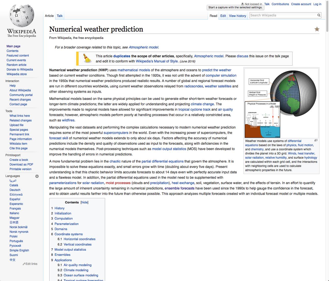
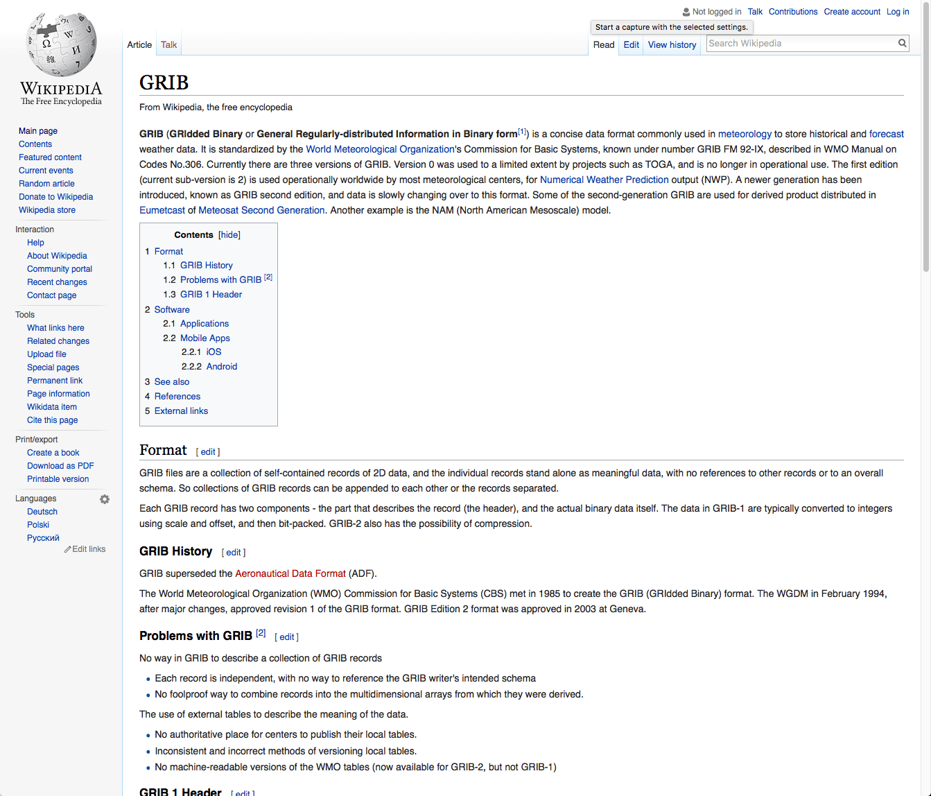
In the dissemination and transmission of data and weather information one of the most established standard is the GRIB (gridded binary) format that allows an Internet transmission of compressed file whose contents can be easily viewed on a computer, a tablet or a mobile phone.
GRIB files can contain a variety of meteorological parameters: pressure, wind, precipitation, waves and many more. These data are produced automatically from the different computers that process the various weather models. These files contains weather information that was not reviewed and vetted by professional meteorologists and hence they have to be used as a complement to the weather forecasts that are made available to mariners by the various institutions dealing with marine forecast for navigation.
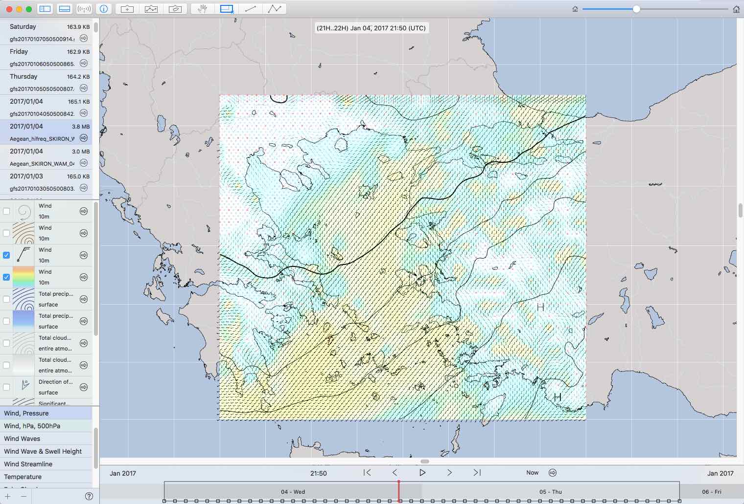
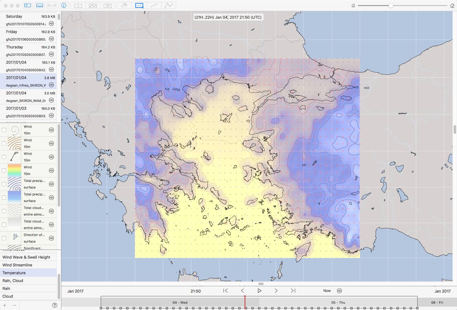
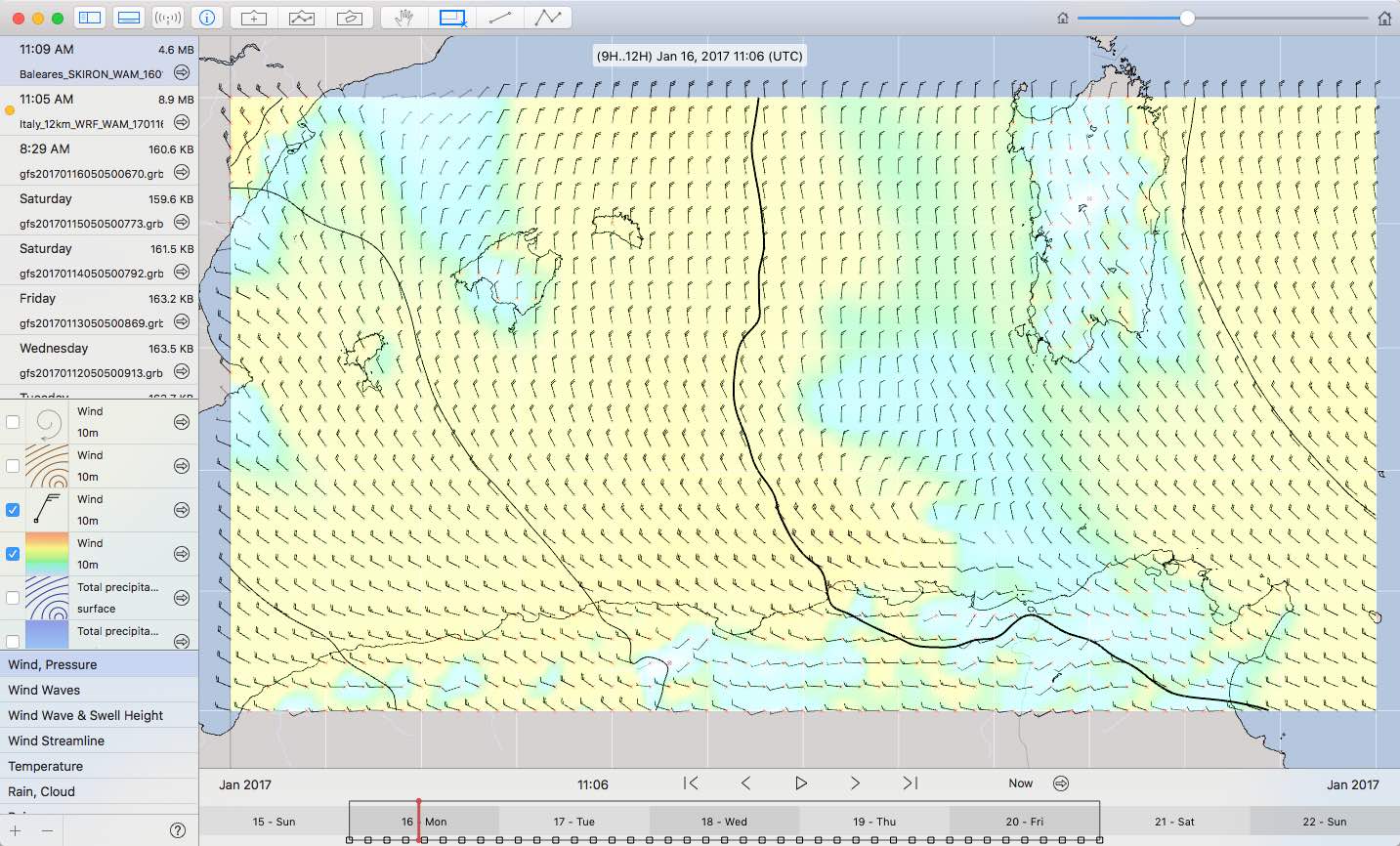
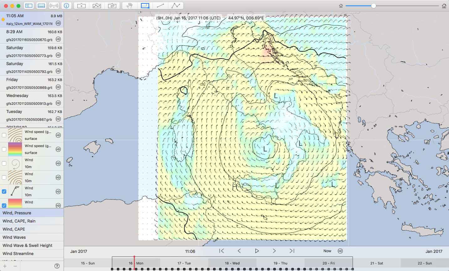
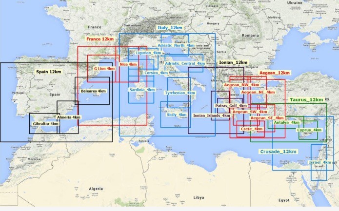
Here are some examples of what we can achieve thanks to today’s technologies:
High resolution WAM model for the Aegean (wind and pressure) in GRIB format
High resolution WAM model for the Aegean (temperature) in GRIB format
Many of the analyzes produced by the various weather models are now distributed in GRIB format and data access services range from free to paid service, with local or global coverage, high, medium and low resolution.
The software that display information in GRIB format offer the possibility to download data in a convenient way. Unfortunately, the data offered often refer to a limited number of models, often the only GFS. It is important to know that we can retrieve the information we care, often at no cost. In the following review of weather models links and references to every model will be provided. Who is willing to contribute with additional information is welcomed.
There are many weather models available, and none is more valuable than the others. They serve different purposes and each model evaluates differently a lot of different factors. low-resolution models are used to assess major variables involved on a large scale, but are ineffective for determining weather forecasts in coastal areas, or where the influence of geography and morphology of the land induces significant changes in the weather dynamics. Other models have a high resolution to capture the best local phenomena, but they have limited validity in the future. A comparison of different models is of great help and can be comforting when all of them converge to the same conclusions. Instead we should be very wary of the weather when models are providing conflicting data between them.
At this point, before describing the different weather models, I think it is important the reference to a parameter often provided by many of them: it is the Convective Available Potential Energy (CAPE), which measures the potential energy in the air. The values of CAPE, in Joules per kilogram allow us to get an idea of the potential for development of storm cells of a specific area. I mention if here because of its importance in navigation.
The following CAPE values provide an indication of the level of instability in an air mass:
0001-1000 J / kg: Marginally Unstable
1000-2500 J / kg Moderately Unstable
2500-3500 J / kg: Very Unstable
3500 J / kg and higher: Extremely Unstable
Below weather models relevant and of interest for sailors are summarized, in alphabetical order. Some of these are also available in GRIB format and can then be downloaded with an internet or wireless connection.
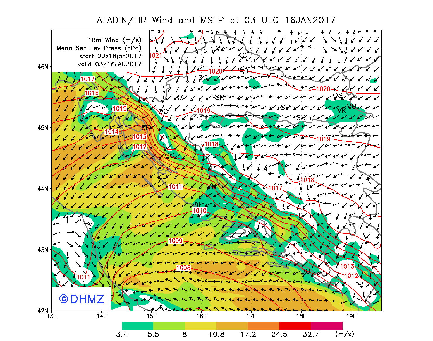
Aire Limitée Adaptation dynamique Développement InterNational (ALADIN)
Consortium sponsored by Météo-France with several countries of Central and Eastern Europe. The consortium managing ALADIN initiated in 2005 a partnership with the consortium in charge of HIRLAM (High Resolution Limited Area Model), another high-resolution model (up to 2 km) used in Europe. The goal of the two consortia is to arrive at an integrated management of the two models.
Wind and pressure, ALADIN – Croazia
Link to the ALADIN consortium website
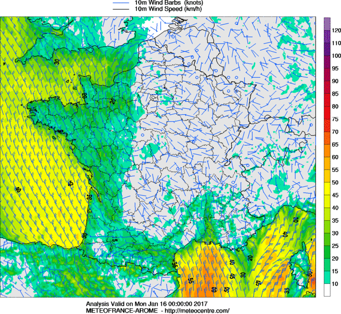
AROME
Model managed by Meteo France to improve short term forecasts of high intensity weather events in the Mediterranean region. Five-day forecast.
Wind, AROME – France
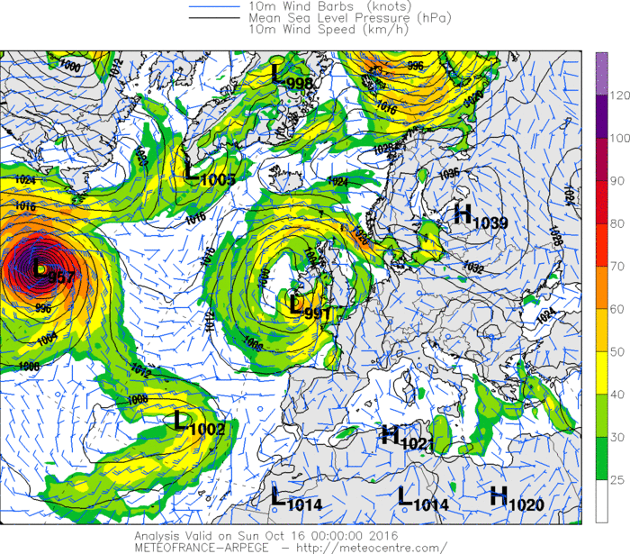
ARPEGE
Global weather model managed by Météo-France
Wind, ARPEGE – Europe
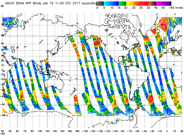
Advanced Scatterometer data (ASCAT)
ASCAT does not refer to a weather model but is a satellite system for real-time analysis of the wind on seas of the globe. Instead of the classic wind forecasts, ASCAT provides us with the wind real values, as read by satellite, for all the world’s seas. The data is collected every hour and have global coverage. This information is also available in GRIB format.
Wind, from ASCAT, 25Km resolution
Atlantic operational Real Timer Ocean Forecasting System (RTOFS)
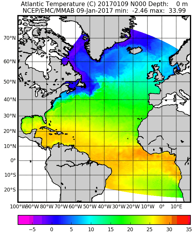
Forecasting model of Atlantic ocean currents maintained by the US National Weather Service.
Current, Atlantic Ocean
Coupled Ocean Atmosphere Mesoscale Prediction System (COAMPS)
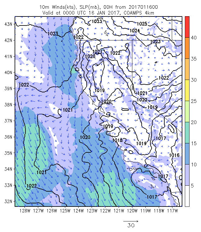
Regional weather model managed by the American Navy. It covers certain regions bordering the United States. Forecasts up to two days. Resolution at 12 Km.
Wind and pressure, COAMPS – California
European Center for Madium-Range Weather Forecasts (ECMWF)
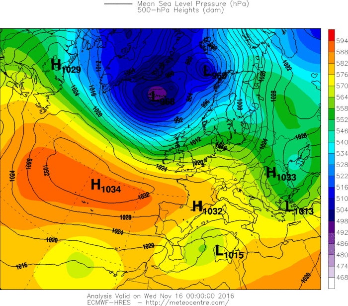
European global weather model. According to many more accurate than the American GFS model. Unfortunately, the data in GRIB format are not accessible to all, being a paid service. Many providers of paid weather information service base their analysis on this model.
Pressure, ECMWF – Europe
GDPS-GEM (Global Environmental Multiscale model)
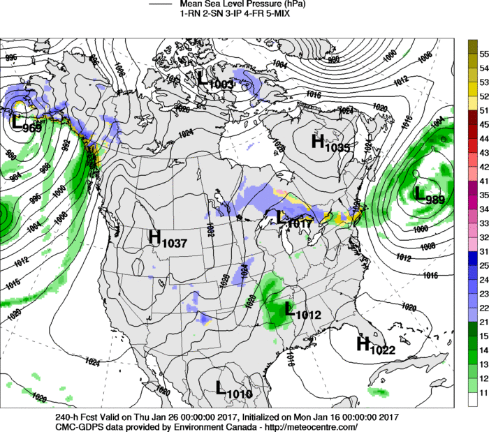
Managed by the Canadian Meteorological Service. Medium and long-term weather forecasts.
Pressure, GEM – United States
GRIB data for GDPS-GEM
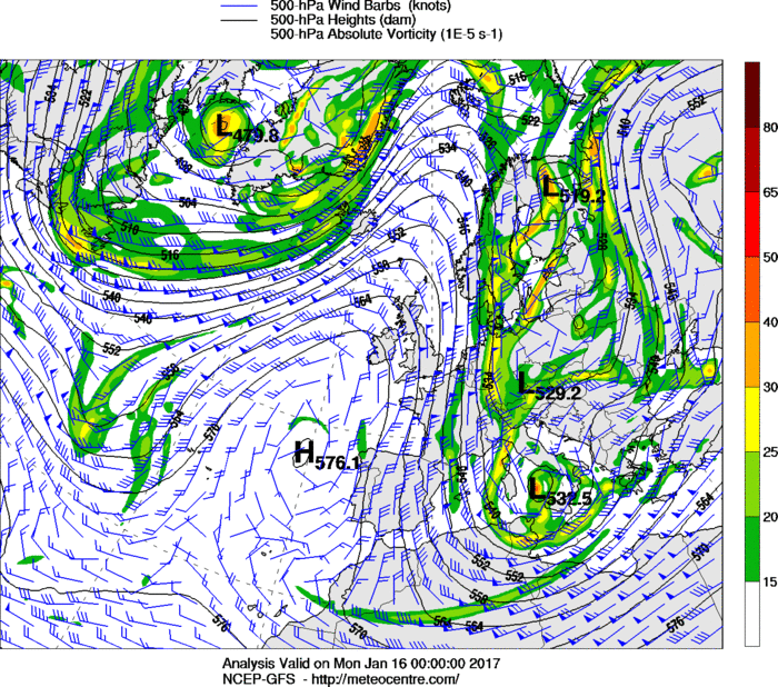
Global Forecast System (GFS)
This is the most known global weather model in use. Updated every six hours by the American meteorological service, with forecasts of up to sixteen days. However, after 4-5 days any model lose confidence and should be used as a general indication fo the future weather. GFS data are available in GRIB format.
Hugh altitude analis
High altitude analysis (500 hPa) GFS – Europe
GRIB data from the GFS weather model
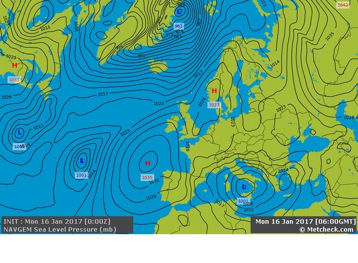
Navy Global Environmental Model (NAVGEM)
Global weather model run by the US Navy. Equivalent to the GFS, useful to compare the validity of the models.
Pressure, NAVGEM – Europe
Information and data about NAVGEM
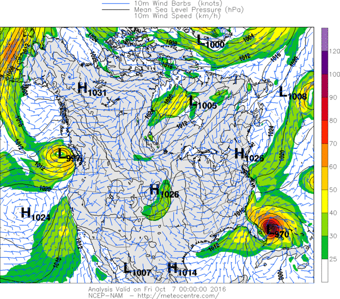
North American Mesoscale Model (NAM)
Regional weather model of the state of the atmosphere, produced by the American Weather Service. It takes into account the small-scale weather phenomena and therefore much more effective than other global models as the GFS. High resolution data but valid for a short period of time: 2/3 days.
Wind, NAM – Nord America
GRIB NAM weather data
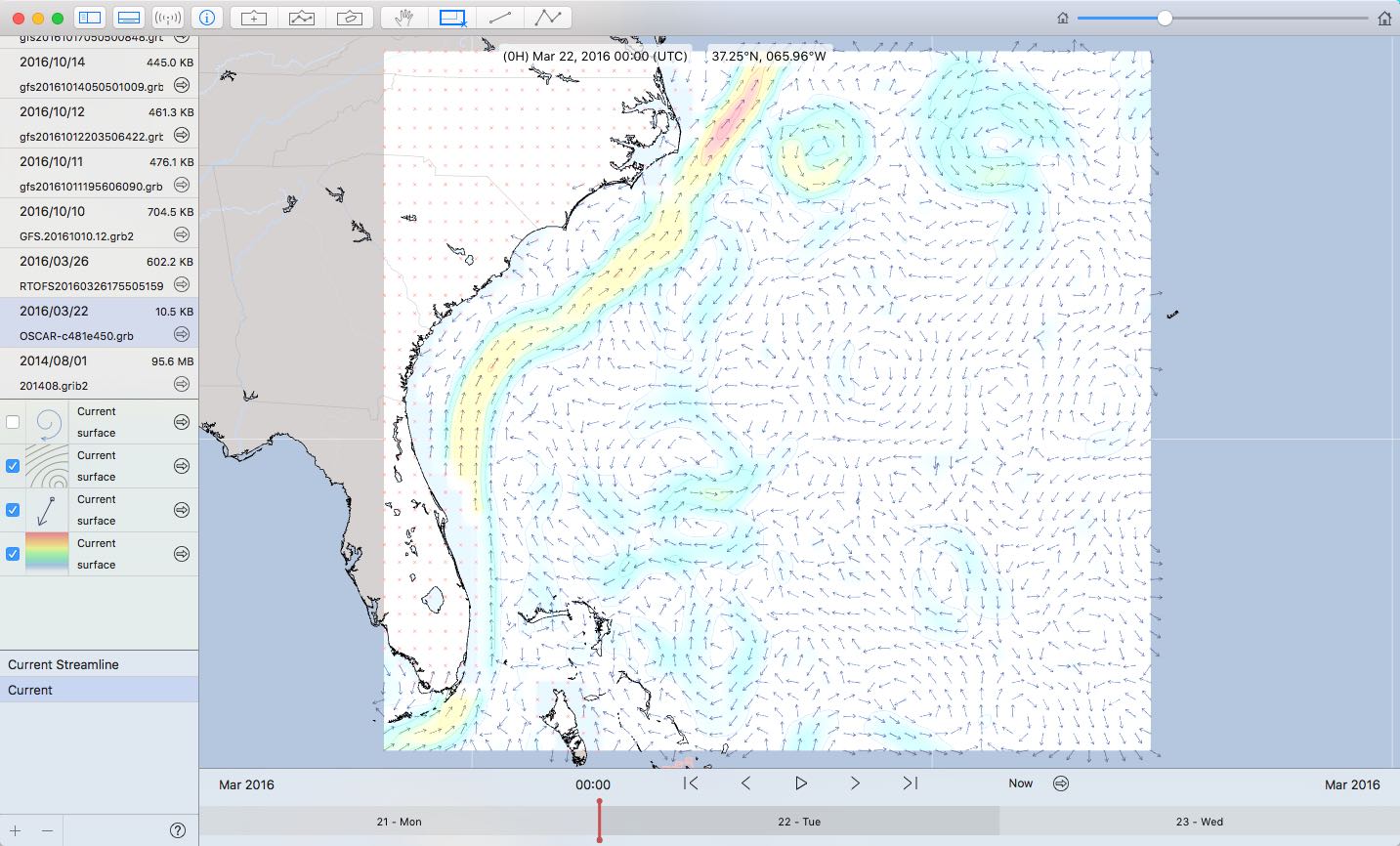
Ocean Surface Current Analysis – Realtime (OSCAR)
Analysis of the global sea currents. The data is calculated through satellite measurements, and model forecasts cover five days. Data available in GRIB format.
GRIB data from OSCAR model with representation of the Gulf Stream
Skiron
High-resolution weather model (grid 5 Km) by the University of Athens. The data in GRIB format are available for the Mediterranean, with forecasts up to five days.
Wind, SKIRON – Balearic
GRIB weather data from SKIRON
Weather Research and Forecasting (WRF)
This weather model covers different areas of the globe and offers high-resolution forecasts that take into account local conditions. The model is used by various institutions and organizations to perform predictive analysis covering certain areas. Useful and reliable in the short-term weather forecasts that take into account the geography and the local topography.
Wind and pressure, WRF – Italy
GRIB weather data of Mediterranean sea from WRF
Wave Watch 3 (WW3)
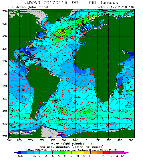
Wave model managed by the American meteorological department. Updated four times a day, with forecast data up to 180 hours.
Wave heights, WW3 – Atlantic Ocean
WW3 model data at the link
Where to get weather information in GRIB format?
The data of many of these models are available in GRIB format free of charge. Here are summarized the main sources that can be accessed.
link to: Gribfiles (paid service)
Mailasail offers an interesting service for free access to a variety of weather information. The instructions to access their free services are located at this link
Openskiron covers the entire Mediterranean with useful high-resolution data. GRIB files can be downloaded from the site.
Saildocs provides a service similar to mailasail and allows to access multiple weather information from their archives by sending an email.
For information on GRIB files available at Saildocs send a blank email to: grib
Information on available weather models at Saildocs can be received by sending a blank email to: models
link to: Norway Meteorogical Service
Ho raccolto alcune informazioni sui modelli meteorologici a beneficio di chi come me, naviga. Spero la cosa possa essere di qualche interesse per tutti gli appassionati di mare. L’elenco non è certamente esaustivo e sono ben felice di accogliere suggerimenti e idee (Paolo) per ampliare e migliorare questa rassegna di modelli meteo.
Il meteo e la navigazione
E’ saggio e auspicabile pianificare la navigazione in funzione delle condizioni meteo che potremo incontrare e di farlo ancora prima di mollare gli ormeggi.
Le crociere si preparano sempre prima della navigazione effettiva e il successo di ogni traversata e di ogni vacanza dipende molto dalla cura avuta nello studiare le condizioni meteo marine che s’incontreranno. La scelta delle rade, l’atterraggio nei porti, le tappe e le destinazioni di ogni navigazione dipendono tutte dalle condizioni del tempo. Cerchiamo così il vento più favorevole per una navigazione comoda e veloce per gettare ancora nel giusto ridosso che ci proteggerà e passare cosi’ una notte senza pensieri riguardo alla tenuta del nostro ormeggio. Il meteo, il vento e il mare sono fattori decisivi per il successo di ogni navigazione. Guardare il tempo e capirne i cambiamenti nel futuro è indispensabile per tutti i navigatori che vogliono affrontare in sicurezza la navigazione, a vela o a motore.
Nel pianificare le crociere facciamo ricorso alle innumerevoli previsioni a cui abbiamo facilmente accesso quando siamo ancora a terra. Tra le informazioni disponibili vi sono i modelli meteo, ormai accessibili con un computer, un tablet o un semplice cellulare.
I modelli meteo
Fortunatamente per i velisti e i naviganti, i modelli meteorologici alla base delle previsioni meteo diventano sempre più accurati e affidabili. Molti di questi sono ormai accessibili al largo pubblico in forma gratuita. Con il miglioramento delle tecnologie e la facilità di accesso a internet anche quando si naviga, diventa quindi possibile per il normale velista, accedere a svariate risorse e informazioni meteo come non era pensabile solo una decina d’anni fa.
Spiegazione generale sulla digitalizzazione delle previsioni meteo
Nella disseminazione e trasmissione di dati e informazioni meteorologiche uno degli standard più affermati è il formato GRIB (GRIdded Binary) che permette la trasmissione via internet di file compressi il cui contenuto è comodamente visualizzabile su un computer, un tablet o con un cellulare.
I files GRIB possono contenere svariati parametri meteorologici: dalla pressione, al vento, alle precipitazioni, alle onde e molti altri ancora. Questi dati sono prodotti automaticamente dai diversi computer che elaborano i vari modelli meteo. Si tratta quindi d’informazioni che non sono state verificate da meteorologi professionisti e che vanno quindi usate come un complemento delle previsioni meteo messe a disposizione ai naviganti dalle diverse istituzioni che si occupano delle previsioni meteomarine per la navigazione.
Ecco alcuni esempi di cosa possiamo ottenere grazie alle tecnologie odierne:
Modello WAM ad alta risoluzione per l’Egeo (vento e pressione) in formato GRIB
Modello WAM ad alta risoluzione per l’Egeo (temperatura) in formato GRIB
Molte delle analisi prodotte dai vari modelli meteo esistenti sono oggi distribuite nel formato GRIB e i servizi di accesso ai dati vanno dal gratuito al servizio a pagamento, con copertura globale o locale, ad alta, media e bassa risoluzione.
I software che visualizzano le informazioni in formato GRIB offrono la possibilità di scaricare i dati necessari con procedure semplici e intuitive. Purtroppo i dati offerti fanno spesso riferimento a un numero limitato di modelli, spesso il solo GFS. E’ importante quindi sapere che l’utente può recuperare direttamente le informazioni che interessano, spesso in forma gratuita. Nella disamina dei modelli fornirò i link e i riferimenti che ho trovato su questo tema. Quanti hanno modo di contribuire con informazioni aggiuntive sono benvenuti.
I modelli meteo sono tanti e non ne esiste uno più valido dell’altro. Essi servono scopi diversi e ogni modello valuta in modo diverso una svariata quantità di fattori. Modelli a bassa risoluzione permettono di valutare le grandi variabili in gioco su larga scala, ma si rivelano poco efficaci per determinare i dati previsionali nelle aree costiere, o dove l’influenza della geografia e della morfologia del terreno induce cambiamenti rilevanti nella dinamica del tempo. Altri modelli presentano un’alta risoluzione per catturare al meglio i fenomeni locali, ma hanno una validità limitata nel tempo. Un raffronto tra diversi modelli può essere confortante quanto tutti convergono verso le medesime conclusioni. E’ invece bene prestare molta attenzione al tempo quando i modelli presentano dati discordanti tra loro.
A questo punto, prima di illustrare i diversi modelli, credo sia importante il riferimento a un parametro spesso presente in modelli: si tratta del Convective Available Potential Energy (CAPE) che misura l’energia potenziale presente nell’aria. I valori del CAPE, in Joules per Kg, ci permettono di farci un’idea del potenziale sviluppo di cellule temporalesche su una determinata area. Lo segnalo qui per la sua importanza ai fini della navigazione.
I seguenti valori del CAPE offrono un’indicazione del livello di instabilità in una massa d’aria:
0001-1000 J/kg: Marginalmente Instabile
1000-2500 J/kg: Moderatamente Instabile
2500-3500 J/kg: Molto Instabile
3500 J/kg e superiore: Estremamente Instabile
Qui di seguito sono riepilogati i modelli meteo, in ordine alfabetico, più rilevanti e d’interesse per i naviganti. Alcuni di questi sono anche disponibili nel formato GRIB e possono quindi essere scaricati con una connessione internet o via radio.
Aire Limitée Adaptation dynamique Développement InterNational (ALADIN)
Consorzio promosso da Météo-France con diversi paesi dell’Europa Centrale e Orientale. Il consorzio che gestisce ALADIN ha avviato nel 2005 una collaborazione con il consorzio a capo del modello HIRLAM (High Resolution Limited Area Model) altro modello ad alta risoluzione (fino a 2 Km) usato in Europa. L’obiettivo dei due consorzi è di giungere a una gestione integrata dei due modelli.
Vento e pressione, modello ALADIN, Croazia
Link al sito del consorzio ALADIN
AROME
Modello curato da Meteo France per migliorare le previsioni a breve periodo di eventi meteo ad alta intensità nella regione del Mediterraneo. Cinque previsioni giornaliere.
Vento, modello AROME, Francia
ARPEGE
Modello globale a cura di Météo-France
Vento, modello ARPEGE, Europa
Advanced Scatterometer data (ASCAT)
ASCAT non fa riferimento a un modello meteo, ma a un sistema satellitare per l’analisi in tempo reale del vento sui mari del globo. Invece delle classiche previsioni del vento, ASCAT ci mette a disposizione i valori reali del vento, come letti da satellite, per tutti i mari del mondo. I dati sono raccolti ogni ora ed hanno copertura globale. Queste informazioni sono anche disponibili in formato GRIB.
Vento, misure ASCAT sul globo, risoluzione 25Km
Atlantic operational Real Timer Ocean Forecasting System (RTOFS)
Modello previsionale delle correnti dell’oceano Atlantico curato dal servizio meteorologico nazionale Americano.
Corrente, Oceano Atlantico
Coupled Ocean Atmosphere Mesoscale Prediction System (COAMPS)
Modello regionale a cura della marina militare Americana. Copre alcune regioni confinanti con gli Stati Uniti. Previsioni fino a due giorni. Risoluzione a 12 Km.
Vento e pressione, modello COAMPS, California
Informazioni sul modello COAMPS
European Center for Madium-Range Weather Forecasts (ECMWF)
Modello globale Europeo. A detta di molti più accurato dell’Americano GFS. Purtroppo i dati in formato GRIB non sono accessibili a tutti, essendo a pagamento. Molti fornitori di servizi d’informazione meteo a pagamento basano le proprie analisi su questo modello.
Pressione, modello ECMWF, Europa
Informazioni sul modello ECMWF
GDPS-GEM (Global Environmental Multiscale model)
A cura del servizio meteorologico Canadese. Previsioni a medio e lungo periodo.
Pressione, modello GEM, Stati Uniti
Informazioni sul modello GDPS-GEM
Dati del modello GDPS-GEM in formato GRIB
Global Forecast System (GFS)
E’ il modello globale più conosciuto e usato. Aggiornato ogni sei ore a cura del servizio meteorologico Americano, con previsioni che arrivano fino a sedici giorni. Comunque dopo 4/5 giorni qualunque modello perde di attendibilità e va quindi usato in via indicativa ai fini della navigazione. I dati GFS sono disponibili gratuitamente nel formato GRIB.
Analisi in alta quota (500 hPa), modello GFS, Europa
Dati del modello GFS in formato meteo in formato GRIB per il modello GFS scaricabili dal sito GRIB
Navy Global Environmental Model (NAVGEM)
Modello globale gestito dalla marina militare degli Stati Uniti. Equivalente al GFS ma utile per raffrontare la validità dei modelli.
Pressure, modello NAVGEM, Europa
Informazioni e dati sul modello NAVGEM
North American Mesoscale Model (NAM)
Modello regionale dello stato dell’atmosfera prodotto dal servizio meteorologico Americano. Tiene in conto dei fenomeni meteo su piccola scala e quindi molto più efficace di altri modelli globali come il GFS. Dati ad alta risoluzione ma validi per un breve periodo: 2/3 giorni.
Vento, modello NAM, Nord America
Dati del modello NAM in formato GRIB
Ocean Surface Current Analysis – Realtime (OSCAR)
Analisi delle correnti globali. I dati sono calcolati attraverso misure satellitari e le previsioni del modello coprono cinque giorni. Dati disponibili in formato GRIB.
Modello OSCAR con rappresentazione della corrente del Golfo, in formato GRIB
Skiron
Modello ad alta risoluzione (griglia a 5 Km) curato dall’Università di Atene. I dati in formato GRIB sono disponibili per il Mediterraneo con previsioni fino a cinque giorni.
Vento, modello SKIRON, Baleari
Dati del modello SKIRON in formato GRIB
Weather Research and Forecasting (WRF)
Questo modello copre diverse aree del globo e offre previsioni ad alta risoluzione che tengono in conto delle condizioni locali. Il modello è utilizzato da diverse istituzioni e organizzazioni per svolgere analisi di previsione che coprono determinate aree. Utile e affidabile nelle previsioni meteorologiche a breve termine che tengono in conto della geografia e orografia locale.
Vento e pressione, modello WRF, Italia
Dati del modello WRF per il Mediterraneo in formato GRIB
Wave Watch 3 (WW3)
Modello del moto ondoso a cura del dipartimento meteorologico Americano. Aggiornato quattro volte al giorno, con dati previsionali fino a 180 ore.
Altezza delle onde, modello WW3, Oceano Atlantico
Dati del modello WW3 al link
Dove recuperare le informazioni meteo in formato GRIB?
I dati di molti di questi modelli sono disponibili nel formato GRIB in forma gratuita. Qui sono riassunte le principali fonti cui è possibile accedere.
link a: Gribfiles (servizi a pagamento)
Mailasail offre un servizio interessante per accedere gratuitamente a svariate informazioni meteo. Le istruzioni per accedere ai loro servizi gratuiti si trovano a questo link
Openskiron copre tutto il mediterraneo con interessanti dati ad alta risoluzione. I file GRIB possono essere scaricati dal sito.
Saildocs offre un servizio simile a mailasail e permette di accedere a molteplici informazioni interrogando i loro archivi inviando una mail.
Per informazioni generali sul servizio Saildocs inviare una mail vuota a: info
Per avere informazioni sui file GRIB disponibili in Saildocs inviare una mail vuota a: grib
Informazioni sui modelli meteo disponibili in Saildocs si possono invece ottenere mandando una mail vuota all’indirizzo: models
link a: Servizio Meteorologico Norvegese

